3D Laser Scanning & Boundary Surveying for High-Stakes Sites
Licensed California surveyor-led reality capture, point clouds, as-built documentation, ADA ramp measurement, condominium conversion support, and forensic boundary surveying for architects, engineers, developers, attorneys, churches, institutions, and property teams across the Bay Area and Northern California.
Book an Expert Scope Meeting
Before You Ask for an Estimate
Serious projects deserve more than a blind number. Book a short meeting with the licensed surveyor, share the project context, and get a scoped estimate when there is enough information to price the work responsibly.
What Happens in the Meeting:
Project Risk Review
$250 valueWe'll identify where bad existing-condition data, incomplete records, slope issues, or unclear boundaries could create delays.
15-Minute Surveyor Consultation
$150 valueSpeak directly with a Licensed Professional Land Surveyor about the right survey, scan, model, exhibit, or as-built scope.
Recommended Deliverable Path
$100 valueWalk away knowing whether you need point clouds, CAD plans, Revit-ready modeling, ADA exhibits, boundary research, or something simpler.
Total Value:
$500FREE
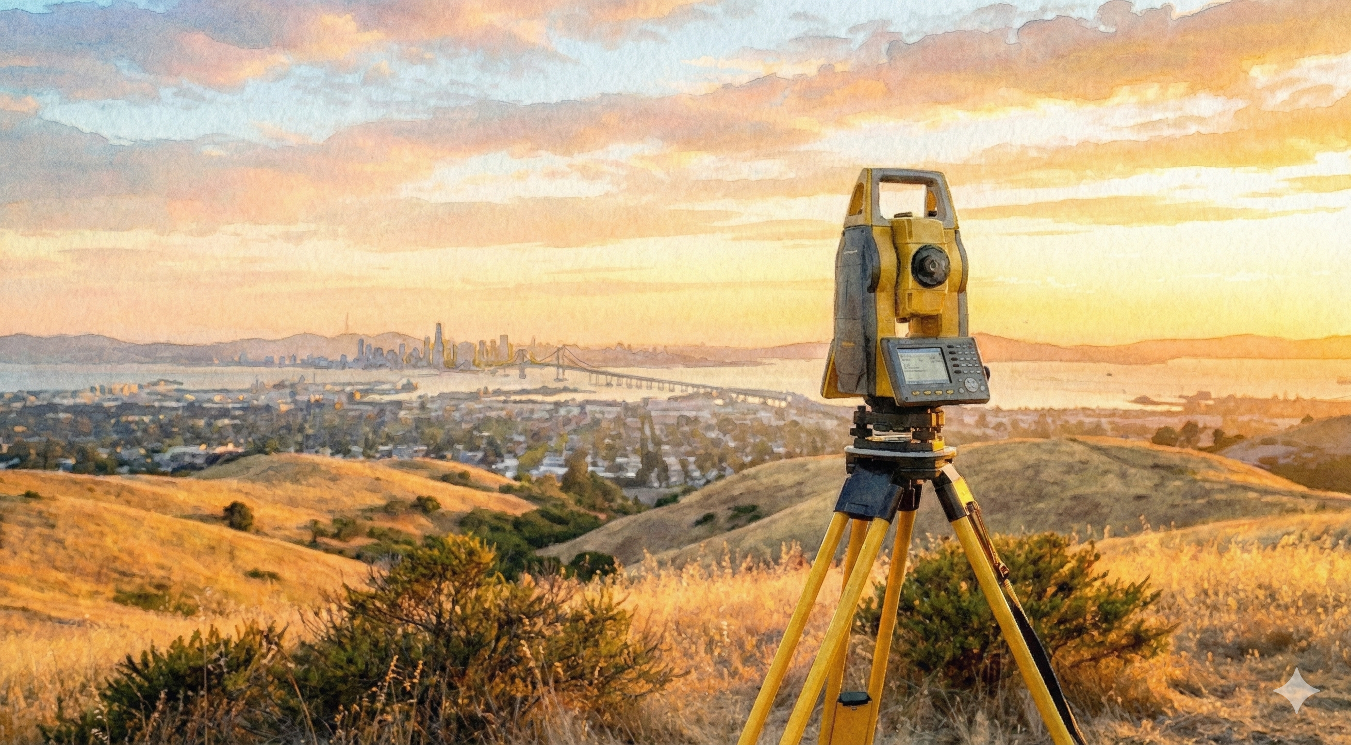
Modern Surveyor-Led Scanning
Reality capture that feels technical before it ever feels generic.
The site is shifting toward clients who value expertise: architects, engineers, developers, churches, institutions, attorneys, owners, and contractors with complicated existing conditions. The work starts with a scope meeting so the deliverable matches the risk, not a guessed-at line item.
01
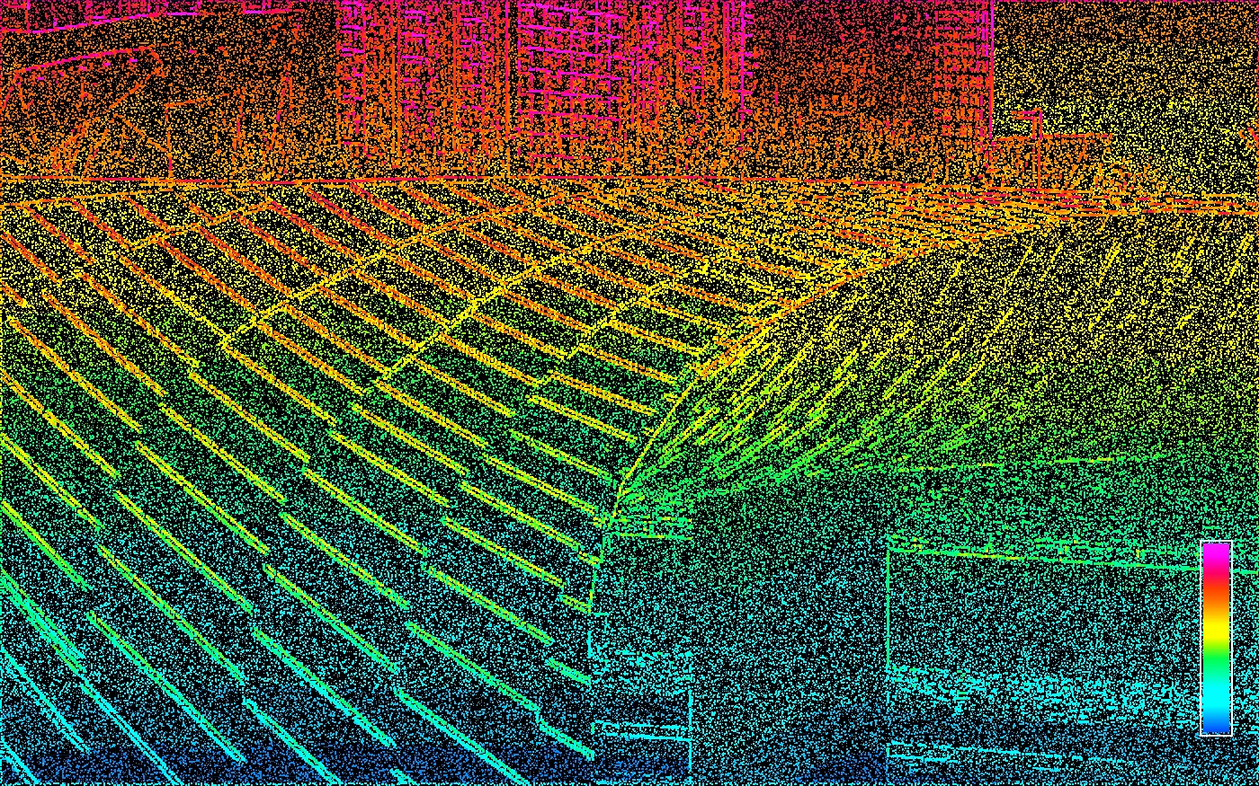
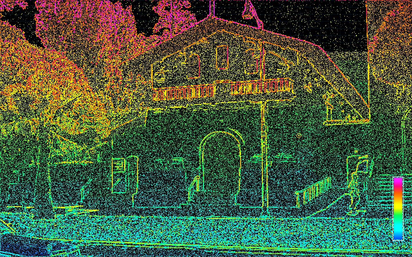
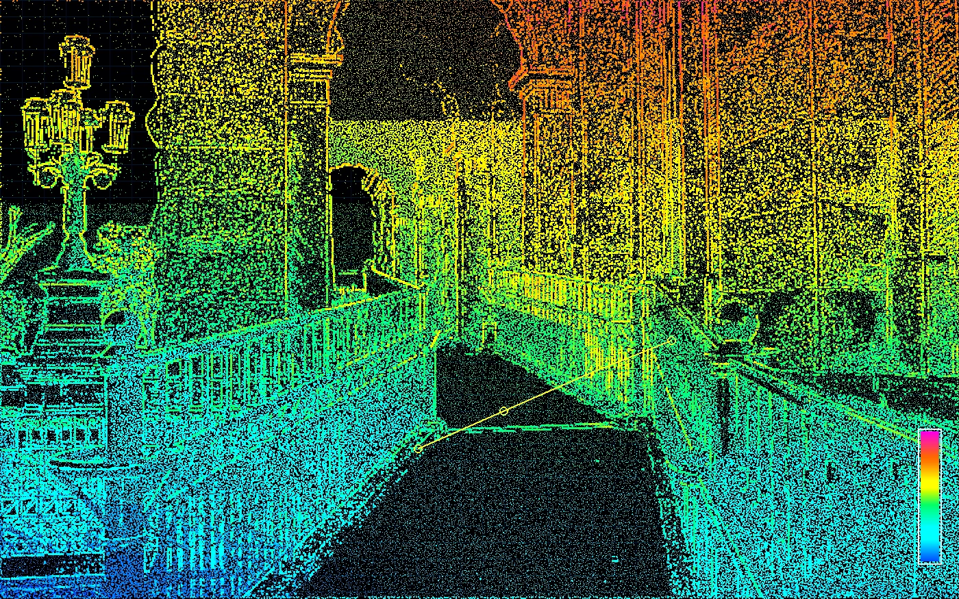
Point cloud capture
Dense existing-condition data captured once for the building, site, route, or disputed area.
02
CAD and model production
Floor plans, sections, elevations, surface data, or BIM-ready geometry built around the actual scope.
03
Surveyor interpretation
Boundary, ADA, construction, and legal context added where a scan alone is not enough.
Northern CA
Hwy 50 / 80 corridor focus
Licensed CA PLS
Survey judgment behind the data
Meeting first
Estimate after real scoping
Focused B2B Survey Niches
Built for teams that need existing-condition certainty.
Contour is focusing where a small, technical California survey practice can create outsized value across Northern California: complex buildings, high-liability measurements, and boundary problems where the cost of being wrong is much higher than the cost of good data.
Architects, engineers, contractors, owners
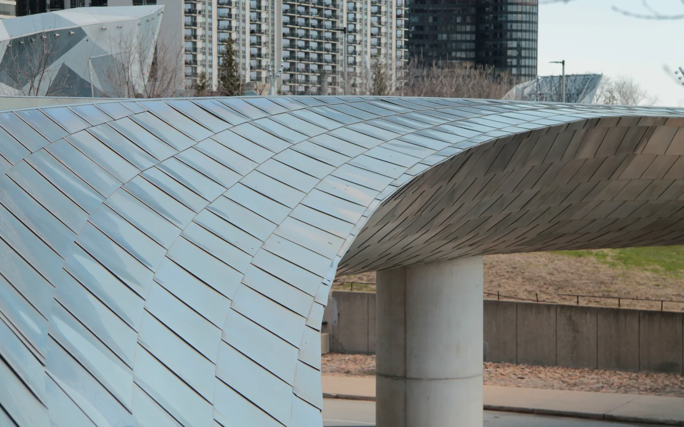
Reality Capture for AEC Teams
Renovations, retrofits, and tenant improvements fail when teams design from stale drawings or partial field notes.
Point clouds, CAD plans, Revit-ready models, and visual 3D records your whole team can trust.
Contractors, owners, geotech, attorneys
Deformation Monitoring & Movement Surveys
Excavation, shoring, dewatering, and adjacent construction can move neighboring buildings, walls, and slopes — and discrete prism points miss what scanning captures across the whole structure.
Scan-based baseline plus repeat epochs, with deformation comparison across the full surface, not just survey points.
Architects, engineers, owners, developers
Site Plan & Stamped Permit Surveys
Many Bay Area jurisdictions — SF, Oakland, Berkeley, Peninsula — require a current site survey wet-stamped by a licensed PLS before plans can be submitted.
Stamped boundary + topographic site plan surveys delivered as CAD-ready base files for permit-ready design work.
Owners, attorneys, architects, developers
Difficult Boundary & Hillside Surveys
Hillside lots, irregular parcels, post-1906 SF blocks, fire-rebuild zones, and conflicting record evidence make Bay Area boundaries hard to pin down.
Defensible boundary determinations from a licensed surveyor with deep Bay Area research experience.
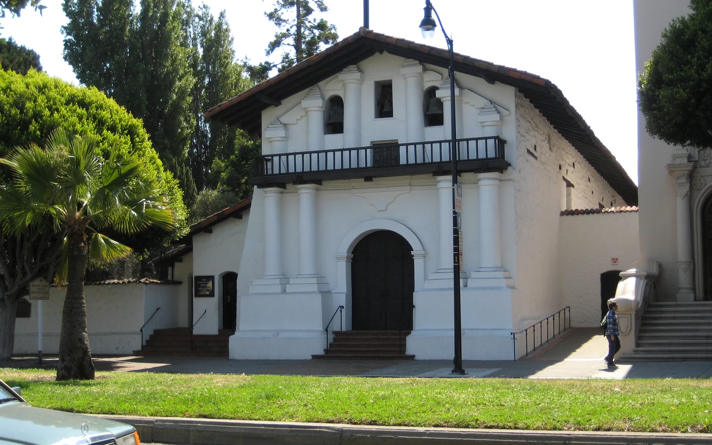
Preservation architects, churches, institutions
Historic Preservation & Adaptive Reuse
Older churches, civic buildings, and custom structures rarely have accurate drawings, and their irregular details are expensive to measure by hand.
Non-invasive digital twin documentation for restoration, facade work, structural coordination, grants, and archives.
Owners, architects, contractors, counsel
ADA Ramp & Route Verification
Small slope, landing, and transition errors can turn into failed inspections, rework, or accessibility claims.
Survey-grade as-built measurements and exhibits for compliance review, correction, and liability defense.
Developers, attorneys, architects, HOA teams
Condo Conversions & Interior As-Built Scanning
Converting an existing building requires dependable interior, exterior, unit, common area, and boundary information — and old plans rarely match what is built.
3D laser scanning of interiors, boundary coordination, CAD-ready as-builts, and mapping support for conversion teams.
Attorneys, owners, developers, insurers
Forensic Boundary & Litigation Support
Disputed lines, encroachments, and contradictory records need more than a quick field measurement.
Historical record reconstruction, defensible survey analysis, exhibits, and expert witness support.
Bay Area Surveyor Search Focus
3D laser scanning and boundary surveying for Bay Area projects.
Contour Survey is built for serious commercial, legal, design, and property teams searching for a licensed surveyor who can combine modern scanning deliverables with defensible California boundary surveying.
3D laser scanning surveyor for Bay Area design teams
High-density terrestrial laser scanning for architects, engineers, contractors, owners, churches, and institutions that need point clouds, scan-to-CAD drawings, Revit-ready models, and as-built documentation before design decisions get expensive.
Site plan surveys for Bay Area permit submittals
Wet-stamped site plan surveys for San Francisco, Oakland, Berkeley, and Peninsula jurisdictions that require a current survey signed by a licensed California PLS before plans are accepted. Boundary plus topographic base maps delivered as CAD-ready files for architects and engineers.
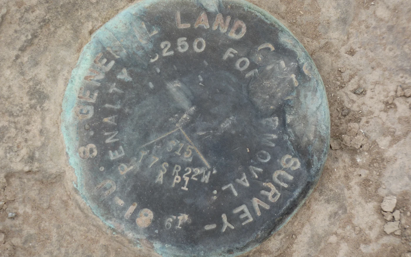
Difficult boundary surveys for Bay Area properties
Licensed boundary surveying for hillside lots, irregular Bay Area parcels, post-1906 SF blocks, fire-rebuild areas, missing monuments, and conflicting record evidence — including Records of Survey and Corner Records when the work needs to be on permanent file.
Boundary surveying for property lines and disputes
Property line location, encroachment analysis, forensic boundary work, and recorded survey documentation across the Bay Area and Northern California.
Deformation monitoring with 3D laser scanning
Scan-based deformation monitoring for adjacent-building risk, retaining wall and slope movement, settlement tracking, historic structures, and excavation-side monitoring. Capture full surface geometry on each epoch instead of relying on a handful of prism points.
Condo conversion surveys with interior 3D scanning
Bay Area condominium conversion surveys built around 3D laser scanning of interiors. Complete unit, common area, and exclusive-use area as-builts, boundary coordination, and CAD-ready documentation for developers, attorneys, and HOA teams.
Local service area signals
Primary coverage includes the San Francisco Bay Area, East Bay, Peninsula, South Bay, Sacramento region, and nearby Northern California communities.
Focused Survey & Scanning Services
Specialized reality capture and boundary services for AEC teams, developers, attorneys, owners, and property managers who need defensible site information.
3D Scanning
Capture existing conditions once and give every stakeholder a reliable source of truth.
Learn MoreHistoric Preservation
Document historic churches, civic buildings, custom homes, and irregular structures without relying on incomplete old drawings.
Learn MoreADA Compliance
Reduce accessibility risk with precise measurements of ramps, landings, routes, slopes, cross-slopes, thresholds, and site transitions.
Learn MoreCondo Conversions
Convert existing buildings into condominium ownership with 3D laser scanning, accurate interior and exterior as-builts, and boundary coordination.
Learn MoreForensic Surveying
Expert investigation and analysis of boundary disputes, encroachments, and property line discrepancies for legal proceedings.
Learn MoreBoundary Determination
Establish clear, legally defensible property boundaries with a licensed Bay Area boundary surveyor — including difficult boundaries on hillside lots, irregular parcels, post-1906 SF blocks, fire-rebuild areas, and properties with conflicting record evidence.
Learn MoreSite Plan Surveys
Stamped site plan surveys, boundary + topographic base maps, and existing-condition documentation for Bay Area permit submittals.
Learn MoreConstruction Staking
Translate design plans into precise field locations for construction.
Learn MoreDispute Mediation
Resolve property line disagreements professionally with a certified mediator who is also a licensed land surveyor.
Learn MoreSubdivisions
Navigate the complex subdivision process with expert guidance.
Learn MoreFence Surveys
Ensure your fence is built in the right location with a professional property line survey.
Learn MoreDeformation Monitoring
Track structural deformation, settlement, and site movement using a combination of high-density 3D laser scanning and precise survey control.
Learn MoreALTA/NSPS Surveys
Bay Area ALTA/NSPS Land Title Surveys for commercial real estate transactions — built to the 2021 ALTA/NSPS Minimum Standard Detail Requirements and the Table A items your lender, title underwriter, or buyer's counsel requires.
Learn MoreWhy Choose Contour Survey
Technical survey support for teams that need reliable measurements, clear deliverables, and defensible documentation.
Licensed Survey Authority
California Licensed Professional Land Surveyor (PLS 9686) bringing defensible measurement to design, ownership, and legal decisions.
B2B Scope Clarity
We respond within 24 hours and help teams define the right point cloud, CAD, model, exhibit, or boundary deliverable before fieldwork starts.
Complex Conditions Experience
With 10+ years of surveying experience and 90+ projects completed, we are comfortable with irregular sites and messy records.
Northern California Context
Deep knowledge of local terrain, permitting expectations, dense urban sites, older buildings, and recording requirements across Northern California.
Reality Capture Workflow
We combine GPS, robotic total stations, and 3D laser scanning with practical CAD and model deliverables that design teams can use.
Legal & Design Communication
We explain technical findings clearly for architects, engineers, owners, attorneys, agencies, and non-survey stakeholders.
How It Works
A practical workflow for teams that need the right data, in the right format, before decisions get expensive.
Define the Risk
We clarify the business problem: design uncertainty, incomplete as-builts, ADA exposure, conversion requirements, or a boundary dispute.
Scope Deliverables
We recommend the right mix of scanning, control, CAD, BIM-ready modeling, exhibits, reports, or county-recorded survey work.
Capture the Site
Our field team collects survey-grade measurements and scan data while coordinating access around active businesses, tenants, and project schedules.
Deliver Usable Proof
Your team receives the drawings, point clouds, models, exhibits, or boundary documentation needed to design, decide, negotiate, or defend.
Frequently Asked Questions
Have a Serious Site, Building, or Boundary Problem?
Book a scope meeting with the licensed surveyor. Estimates are prepared for projects with enough context to price responsibly.
Meeting-first estimates • Response within 24 hours • Serious projects only